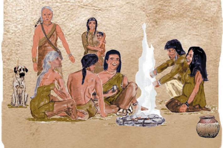
Monongahela Culture Timeline 1050 to 1635
The Monongahela culture were a Native American cultural manifestation of Late Woodland peoples from AD 1050 to 1635 in present-day western Pennsylvania, western Maryland, eastern Ohio, and West Virginia. The culture was named by Mary Butler in 1939 for the Monongahela River, whose valley contains the majority of this culture’s sites.
The Monongahela practiced maize agriculture, and lived in well laid out villages, some of which consisted of as many as 50-100 structures. They traded with other Indian groups who in turn traded with Europeans. The Monongahela seem to have disappeared some time during the 1620s or 1630s before having significant direct contact with Europeans.
Many scholars believe this to be the result of the spread of European infectious diseases. Others believe that most of the Monongahela were killed by or assimilated into either the Iroquois or the Algonquian-speaking Lenape tribes during warfare, as the more powerful tribes competed to control area hunting grounds for the fur trade. Still others claim that two severe droughts, one from 1587 to 1589 and another from 1607 to 1612, drove the Monongahela from the region in search of a more habitable area.
Location of Selected Sites in North Central West Virginia
The Monongahela culture extended in the area of the upper Ohio River system that includes the Monongahela, Youghiogheny and Casselman tributary rivers. Their region was of western Pennsylvania and the adjoining areas of eastern Ohio, West Virginia, and western Maryland. Nearly four hundred archeological sites have been recorded. The culture was contemporaneous to the bordering Fort Ancient culture in the Ohio Valley.
The Monongahela is a Late Woodland horizon that coincides with the Mingo homeland and distinguishes it from the Iroquois League homeland, centered in present-day New York state. Monongahela villages originated on flood plains, but by 1250, the people had migrated to the watershed highlands and often lived on gaps between ridges. Archaeologists speculate that the move to these areas, and construction of larger, fortified villages at this time was a symptom of intergroup warfare.
The Fort Hill Site (46MG12) in Morgantown, West Virginia is a nearly 5-acre (20,000 m2) archeological site that includes what appears to be a Monongahela village. The site has good preservation. A human burial, animal bones, bone beads, a marginella-shell bead, shell-tempered pottery and triangular arrow points have been recovered during excavations at the site. In 2002 the site was endangered with destruction by commercial development. (Suncrest Towne Center)
The majority of the 18 known sites within the Osage USGS Quadrangle and the Blacksville USGS Quadrangle on the environs of the Pennsylvania and West Virginia border are of the Monongahela Culture. The Worley village Complex (46Mg23) dates to about AD 900. It is located within the Blacksville USGS Quadrangle, as is the recently found Wana village site, which was revealed by infrared photography. A field test at the Wana site confirmed pottery, shell, and flint present. It has not yet been studied.
The LaPoe (46Mg21) village complex in Monongalia County, West Virginia is a circular village occupied during the 16th and 17th centuries, with trade items recovered. Nearby LaPoe, 46Mg18 is a stone burial mound. Also located at LaPoe is the village site 46Mg20. Pyle Farm, 46Mg15, is a late prehistoric village site that is located in the Osage USGS Quadrangle. In addition, hundreds of undocumented archeological sites exist in the Dunkard Creek Watershed of Greene County, Pennsylvania and Monongalia County, West Virginia.
>>>>>>………………>>>>>>………………>>>>>>
See also: THE MYSTERY OF THE MONONGAHELA INDIANS, Pennsylvania Historical and Museum Commission, 1999
As part of the U.S. 219 Meyersdale Bypass project, and in keeping with the provisions of the National Historic Preservation Act, an archaeological survey of the project area was conducted to determine the impact of the roadway construction on cultural resources. The survey identified 68 archaeological sites, of which 21 were evaluated for their eligibility to the National Register of Historic Places. Eight of these sites were ultimately selected for intensive data recovery excavations. The artifacts recovered from the archaeological excavations belong to the State of Pennsylvania and are permanently stored at the Pennsylvania Historical and Museum Commission in Harrisburg, Pennsylvania. This booklet presents some of the results of research and excavations conducted as part of the project.
http://www.phmc.state.pa.us/portal/communities/archaeology/files/mysteryofmonindians.pdf
